Africa Splitting Into Two Continents: What the East African Rift Shows
- The Somali plate is pulling away from the Nubian plate along the East African Rift, splitting Africa very slowly.
- The plates separate by roughly 0.2 to 0.5 inches (5 to 13 mm) a year, fastest near Ethiopia.
- In 2005 a 60 km dike in Afar opened the ground by meters in days, centuries of motion at once.
- A new ocean is expected in at least 5 to 10 million years, likely flooding in from the Red Sea and Gulf of Aden.
- The viral 2018 crack in Kenya was mostly erosion, not proof of an imminent split.
- What is happening in the East African Rift?
- The Afar triangle: where three plates meet
- The 2005 Dabbahu fissure: a rift opening in days
- How fast is Africa splitting? Rates in millimeters per year
- When will Africa split into two continents? The timeline
- What would a split mean for Africa?
- Myths about Africa splitting in two
- How scientists watch the rift
- The bottom line
Yes, Africa is splitting into two continents, but on a timescale so slow that no one alive will see it finished. Along the East African Rift, the Somali plate, which carries the Horn of Africa and much of the east coast, is pulling away from the larger Nubian plate that holds the rest of the continent. The two plates separate by roughly 0.2 to 0.5 inches (about 5 to 13 millimeters) a year, and geologists estimate it will take at least 5 to 10 million years before seawater floods the rift and a new ocean basin divides the landmass.
That answer hides a far more interesting story. The rift is not a single crack but a 3,500-kilometer system of valleys, volcanoes and faults that has been growing for about 25 million years. In one corner of Ethiopia, the Afar region, three tectonic plates meet, and the ground there has already torn open in front of scientists. This guide explains what is actually happening under East Africa, how fast it is moving, what the famous 2005 fissure did and did not prove, and which viral claims about Africa "breaking in half" are wrong.
What is happening in the East African Rift?
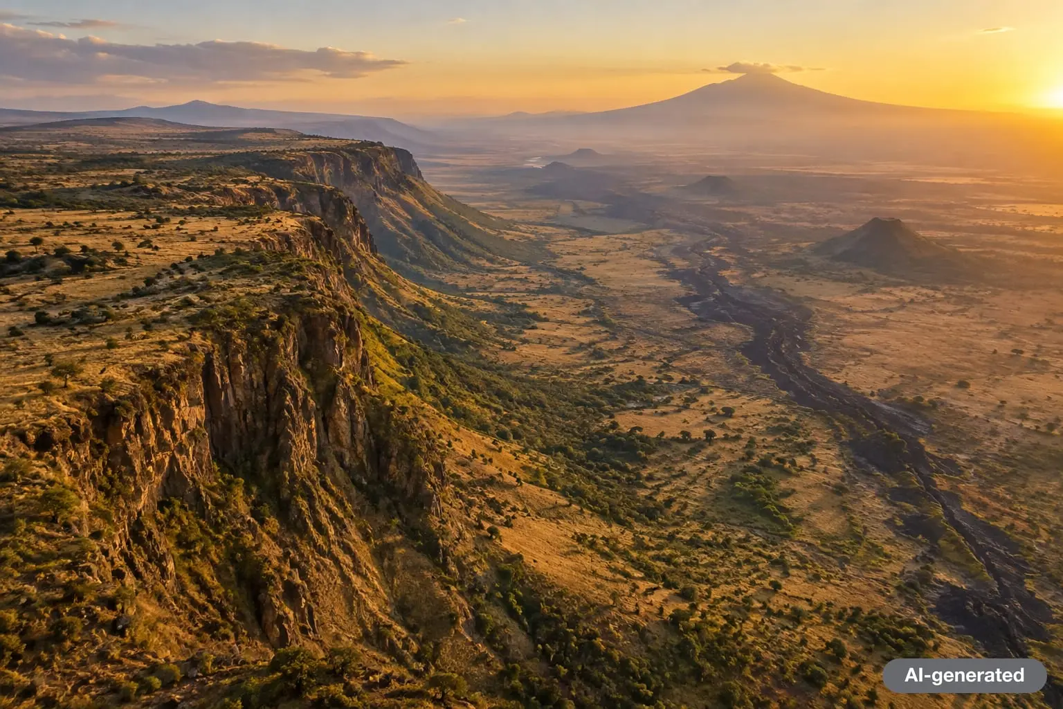
The East African Rift is what geologists call a divergent plate boundary in the making. The Geological Society of London describes it as a developing boundary where the eastern portion of Africa, the Somali plate, is pulling away from the Nubian plate. As the crust stretches, it thins and breaks along steep normal faults. Blocks of land drop between those faults, creating the long, low valleys separated by high shoulders that you can see from orbit.
The system has two main branches. The eastern branch runs through Ethiopia and Kenya and is rich in volcanoes; it includes Erta Ale, a shield volcano in Ethiopia with an active lava lake. The western branch arcs from Uganda down to Malawi and holds a chain of deep lakes, including Lake Tanganyika, the second-deepest lake on Earth. The western arm has fewer volcanoes but deeper and more frequent earthquakes.
According to the Geological Society, the rift began forming in the Miocene epoch, about 25 million years ago, starting at the Afar triple junction and extending southward over time. A 2018 explainer in The Conversation by geologist Lucia Perez Diaz put it this way: the fractures did not all form at once, but followed a sequence that started in Afar around 30 million years ago and propagated toward Zimbabwe.
Why does the crust stretch at all?
Most geologists link the rift to unusually hot mantle rising beneath East Africa. Heat from below lifts the region, weakens the lithosphere and helps pull it apart. The Geological Society notes that the exact source of that heat is still debated, but most researchers connect it to mantle plume activity. This upwelling has also been used to explain why the plateaus of eastern and southern Africa sit so high, a feature sometimes called the African Superswell.
In June 2025, a team led by the University of Southampton added a striking detail. Publishing in Nature Geoscience, the researchers analyzed more than 130 volcanic rock samples from Afar and the Main Ethiopian Rift and found chemical "stripes" repeating across the rift arms. Their interpretation: a single, asymmetric plume beneath Afar that pulses upward, which co-author Tom Gernon compared to a heartbeat. The pulses appear to travel more efficiently where plates spread faster, such as under the Red Sea. The study involved ten institutions, including Addis Ababa University and the GFZ German Research Centre for Geosciences.
The Afar triangle: where three plates meet
If you want to stand on the exact spot where a continent is breaking, the Afar region of northeastern Ethiopia, along with parts of Eritrea and Djibouti, is the place. Here the Nubian, Somali and Arabian plates meet in a Y-shaped pattern known as a triple junction. Three rifts converge: the Red Sea Rift, the Gulf of Aden Rift and the Main Ethiopian Rift.
The Arabian plate has been moving away from Africa for about 30 million years, a process that opened the Red Sea and the Gulf of Aden. Those two arms are already oceans in the making, with seafloor-style crust forming along their axes. The third arm, the East African Rift, lags behind. It is still continental crust being stretched, which is why scientists treat the region as a natural laboratory.
"This is the only place on Earth where you can study how continental rift becomes an oceanic rift." Christopher Moore, University of Leeds, speaking to NBC News in 2020
Afar is also brutally hot. Tulane University geophysicist Cynthia Ebinger, who has led numerous field campaigns there, told NBC News that daytime temperatures often reach 130 degrees Fahrenheit and cool only to about 95 degrees at night. Much of the floor of the Afar depression lies below sea level, which matters for the long-term future described below.
The 2005 Dabbahu fissure: a rift opening in days
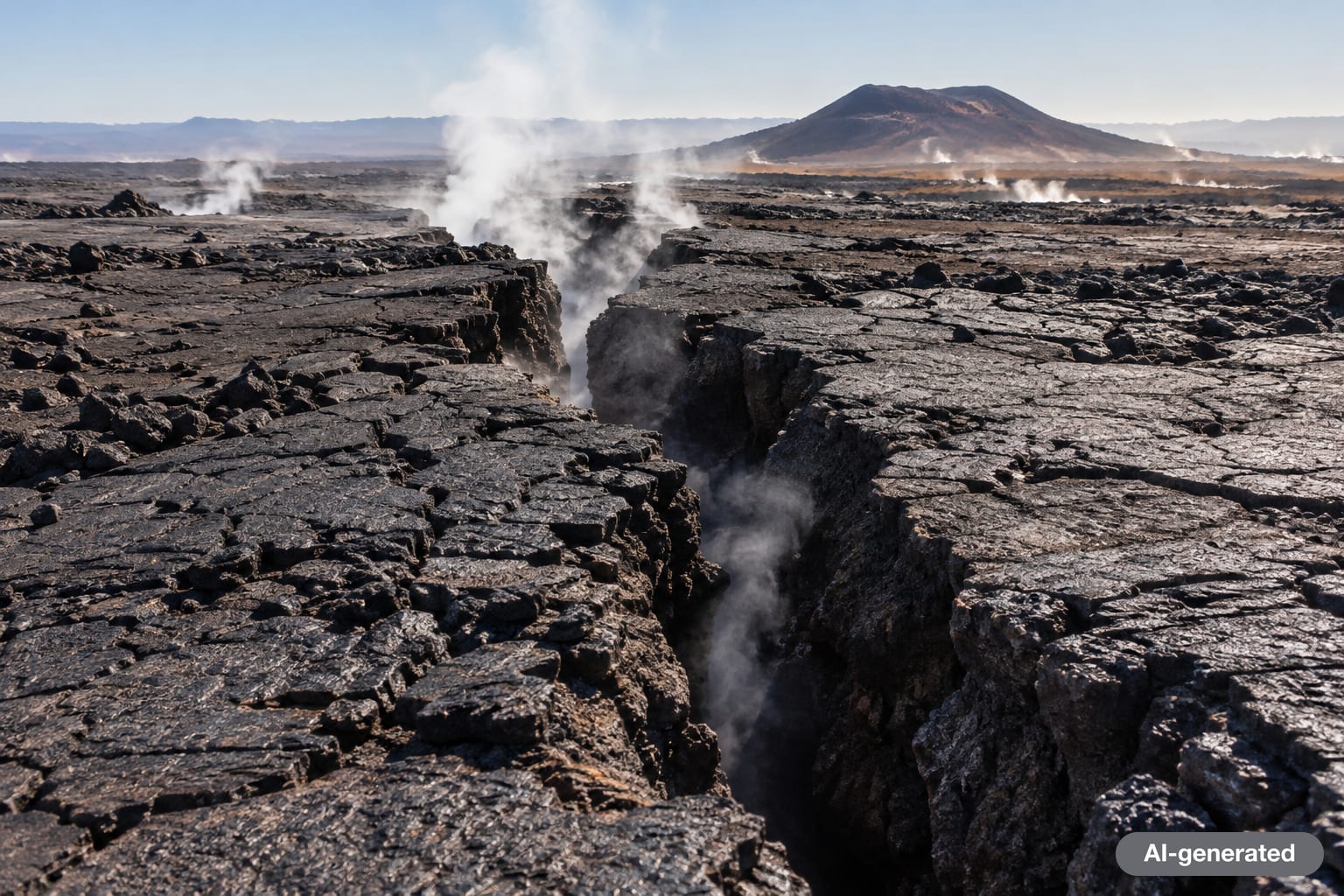
Most of the time, plate motion is invisible. In September 2005, it was not. Between September 14 and October 4, 2005, a swarm of 163 earthquakes larger than magnitude 3.9 struck the Dabbahu segment of the Afar rift, accompanied by a small volcanic eruption between the Dabbahu and Gabho volcanoes. Satellite radar later showed that magma had forced its way upward as a vertical sheet, called a dike, about 60 kilometers (roughly 35 miles) long.
As the dike pushed in, the ground above it split. Fissures opened across the desert and the land on either side moved apart by several meters. Cynthia Ebinger described the event to NBC News as equivalent to several hundred years of tectonic plate movement in just a few days.
The 2005 episode changed how scientists think about rifting. Instead of a smooth, steady creep, breakup appears to happen in long quiet intervals punctuated by sudden injections of magma. Ebinger's later research focused on what triggers those jerks; she compared built-up magma pressure to an overfilled balloon that needs only a small push to pop. Over the following years, more dikes intruded the same segment, letting researchers watch a young spreading center grow in near real time.
The Dabbahu fissure showed that continental breakup can advance in violent bursts, and that magma, not just stretching, does much of the work. It did not mean Africa was about to split. One episode moved a single rift segment by meters; the continent-scale process still requires millions of years of repeated events.
How fast is Africa splitting? Rates in millimeters per year
Modern GPS networks can measure ground motion to within a few millimeters per year. Ken Macdonald, a marine geophysicist and professor emeritus at the University of California, Santa Barbara, summarized the rates to NBC News: the Arabian plate is moving away from Africa at about 1 inch a year, while the Nubian and Somali plates are separating more slowly, between about 0.2 and 0.5 inches a year. Peer-reviewed GPS studies, such as the 2014 "Present-day kinematics of the East African Rift" paper in the Journal of Geophysical Research, show that the opening rate is not uniform: it is fastest in the north near Ethiopia and slows toward the south.
| Measurement | Figure | Source |
|---|---|---|
| Age of the East African Rift | About 25 million years | Geological Society of London |
| Length of the rift system | About 3,500 km (2,170 miles), Red Sea to Mozambique | Geological Society of London |
| Arabia moving away from Africa | About 30 million years, roughly 1 inch (25 mm) per year | NBC News, citing UC Santa Barbara |
| Somali plate vs. Nubian plate | About 0.2 to 0.5 inches (5 to 13 mm) per year | NBC News, citing UC Santa Barbara |
| 2005 Dabbahu dike | About 60 km long; 163 quakes above M3.9 in three weeks | Peer-reviewed seismic studies |
| Time until a new ocean forms | At least 5 to 10 million years | NBC News; University of Rochester |
| South Atlantic opening (for comparison) | About 138 million years ago | The Conversation, citing peer-reviewed work |
To put the Somali-Nubian rate in perspective, a few millimeters a year adds up to a few kilometers per million years. That is fast enough to reshape a continent over geological time, and slow enough that a house built on the rift floor today would not notice the plate motion over its lifetime, even though earthquakes and volcanic events along the way can be very noticeable.
When will Africa split into two continents? The timeline
The most quoted estimate is that a new ocean will take at least 5 to 10 million years to form. That figure comes from the general behavior of rifts that have succeeded before. The South Atlantic, for example, opened when South America and Africa broke apart around 138 million years ago, and the matching coastlines on either side still show the fit.
The process is expected to unfold in stages:
- Continental stretching (now, across most of the rift). Faults widen the valleys, volcanoes erupt and earthquakes are spread across a broad zone. This is the stage the southern and western parts of the rift are in.
- Magma-dominated rifting (now, in Afar and northern Ethiopia). The crust has thinned to the point that dikes do most of the work, as in 2005. The Conversation notes that the entire rift floor in Afar is covered in volcanic rock, suggesting the lithosphere there is close to full breakup.
- Flooding. As the rift floor subsides, water from the Red Sea and Gulf of Aden is expected to pour in over Afar, which already lies partly below sea level. Macdonald told NBC News the gulf and the sea "will flood in over the Afar region and into the East African Rift Valley and become a new ocean."
- Seafloor spreading. New basaltic oceanic crust forms along a mid-ocean ridge between the Nubian and Somali plates. Over tens of millions of years, spreading is expected to advance along the length of the rift.
None of this is guaranteed. The Geological Society points out that some rifts stall and fail; it even describes the eastern branch as representative of a mature continental rift system that may not complete the job everywhere. The northern section, where three plates are actively pulling apart and magma is abundant, is the most likely to succeed first.
What would a split mean for Africa?
If rifting continues to completion, the map would change in a few clear ways:
- A new landmass in the Indian Ocean. The Conversation describes the eventual result as a large island composed of parts of Ethiopia and Somalia, including the Horn of Africa. Some descriptions extend the separated block south through Kenya and Tanzania, depending on which rift branches finally break through.
- New coastlines for landlocked countries. Countries that are landlocked today, such as Uganda or Zambia, could, in some scenarios, end up closer to a coast, though the exact geography depends on where the rift opens fully.
- A smaller "main" Africa. The Nubian plate would carry the bulk of the continent, while the Somali side becomes its own microcontinent or island.
For people living in East Africa now, the relevant effects are the ones happening along the way: earthquakes, volcanic eruptions and ground deformation. Satellite monitoring of volcanoes in the region, such as the radar work described by University of Leeds researchers, exists precisely because these hazards are real on human timescales even if the ocean is not.
The upside: heat, minerals and fossils
Rifting also brings benefits. Hot crust close to the surface makes the region one of the world's most promising areas for geothermal energy, and Kenya already generates a large share of its electricity this way. The rift's subsiding basins trapped the lake and river sediments that preserved many of the most important early human fossils ever found, which is why the valley is often called a cradle of humankind.

Myths about Africa splitting in two
Myth 1: "A giant crack in Kenya proves Africa is splitting now"
In March 2018, after heavy rain, a long crack opened in Kenya's Rift Valley near Mai Mahiu and damaged part of the Nairobi-Narok road. Photos went viral as proof that the continent was tearing apart. Geologists quickly pushed back. A National Geographic education blog quoted an expert saying the cracks had "nothing to do with splitting of the continent" and that gushing water was sweeping away volcanic ash. The Conversation updated its own article to note that the feature was most likely an erosional gully, though it may have followed the line of an old, buried rift fault.
Myth 2: "Africa will split within our lifetime"
No credible scientific estimate supports this. The minimum figure scientists cite is 5 million years for a new ocean. Sudden events like the 2005 Dabbahu dike can move a rift segment by meters, but they do not complete continental breakup.
Myth 3: "The whole rift is opening at the same speed"
Rates vary along the rift. Opening is fastest in the north near Afar and slows to the south, and the western branch behaves differently from the eastern. GPS studies use separate blocks, including smaller microplates such as the Victoria microplate, to describe this patchwork motion.
Myth 4: "Africa is splitting because of climate change or human activity"
Plate tectonics is driven by heat inside the Earth and by forces at plate boundaries. Rainfall can expose old faults, as in Kenya in 2018, but it does not create tectonic rifts.
Myth 5: "It will be the sixth ocean"
Headlines sometimes call the future basin Earth's "sixth ocean." Geologists generally describe what will form first as a narrow ocean basin, similar to today's Red Sea. Whether it ever grows large enough to be counted alongside the Atlantic or Pacific is a question for tens of millions of years from now.
How scientists watch the rift
Several tools let researchers track change that is far too slow to see:
- GPS stations measure how individual points on the ground move each year, down to a few millimeters. Macdonald told NBC News that GPS has "revolutionized" the field.
- Satellite radar (InSAR) compares radar images over time to map ground uplift, sinking and opening. It was key to measuring the 2005 dike.
- Seismometers record earthquake swarms that reveal magma moving underground.
- Rock chemistry from lava flows, like the more than 130 samples in the 2025 Southampton study, reveals what the mantle beneath is doing.
Those methods have shifted the debate from whether Africa is splitting to how and where breakup succeeds first. If you enjoy the long view of planetary change, our space coverage looks at the same forces on other worlds, and the science section collects more explainers like this one.

The bottom line
Africa is splitting into two continents in the only sense geology allows: slowly, unevenly and with occasional violent bursts. The Somali plate is drifting from the Nubian plate by millimeters a year, the Afar triangle is already halfway between a continent and an ocean, and the 2005 Dabbahu fissure gave scientists a rare look at breakup in action. A new ocean is plausible, but at least 5 to 10 million years away. Until then, the rift's real stories are its volcanoes, its earthquakes, its geothermal power and the fossils that record our own origins.
Frequently asked questions
Is Africa really splitting into two continents?
Yes. The Somali plate in eastern Africa is slowly pulling away from the Nubian plate along the East African Rift. If the process continues, a new ocean basin could separate the Horn of Africa and part of East Africa from the rest of the continent.
How long will it take for Africa to split?
Scientists estimate at least 5 to 10 million years before seawater floods the rift and a new ocean forms. Full separation along the whole rift would take tens of millions of years.
How fast are the plates moving apart?
The Somali and Nubian plates separate by roughly 0.2 to 0.5 inches (about 5 to 13 millimeters) a year, fastest in the north. The Arabian plate moves away from Africa faster, at about 1 inch a year.
What happened in Afar in 2005?
In September and October 2005, magma forced its way into the crust of the Dabbahu rift segment in Ethiopia, forming a dike about 60 km long. Fissures opened at the surface and the ground moved apart by several meters, equal to centuries of normal plate motion in days.
Was the 2018 crack in Kenya caused by Africa splitting?
Mostly no. Geologists concluded it was an erosional gully formed when heavy rain washed away soft volcanic ash, possibly along an old fault line. It was not a sudden sign of the continent tearing apart.
Which countries would be on the new landmass?
Descriptions vary, but the separated block would include parts of Ethiopia and Somalia and the Horn of Africa, with some scenarios extending south through Kenya and Tanzania depending on where the rift fully opens.
Sources
- Geological Society of London: East African Rift Valley
- NBC News: The African continent is very slowly peeling apart (2020)
- The Conversation: Africa is splitting in two, here is why
- University of Southampton via EurekAlert: Scientists detect deep Earth pulses beneath Africa (2025)
- Nature Geoscience: Mantle upwelling at Afar triple junction shaped by overriding plate dynamics
- Journal of Geophysical Research: Present-day kinematics of the East African Rift
- Geophysical Journal International: Seismicity of the Dabbahu (Afar) rift
- National Geographic Education: Africa is rifting apart, but this crack in Kenya does not have much to do with it



Log in to comment
No comments yet. Be the first.