Bermuda Triangle Mystery Explained: What the Records Show
- NOAA, the Navy and the Coast Guard say ships and planes vanish no more often there than in other busy waters.
- The name was coined by Vincent Gaddis in Argosy in February 1964 and popularized by Charles Berlitz in 1974.
- Flight 19 most likely ditched in rough seas after its leader lost his bearings; its rescue plane probably caught fire.
- USS Cyclops, lost with 306 people in 1918, likely suffered structural failure under a dense ore cargo.
- Storms, the Gulf Stream, rogue waves, deep water and heavy traffic explain the losses without any mystery.
- What and where is the Bermuda Triangle?
- Where the legend came from: Gaddis, 1964, and Berlitz, 1974
- Famous Bermuda Triangle cases: what the records say
- What NOAA, the Navy and the Coast Guard say
- Natural explanations: why ships and planes really go missing
- Why the Bermuda Triangle myth persists
- The bottom line
The Bermuda Triangle mystery, explained in one sentence: there is no evidence that ships or planes vanish there more often than in any other busy stretch of ocean. That is the position of the National Oceanic and Atmospheric Administration (NOAA), and the U.S. Navy and U.S. Coast Guard say the same. The losses that built the legend are real, but they are best explained by hurricanes, the fast and moody Gulf Stream, shallow reefs, heavy traffic and human error, amplified by a few writers who turned scattered tragedies into a "pattern."
That conclusion does not make the story boring. Some of the cases at the heart of the myth, like the 1918 loss of the USS Cyclops and the 1945 disappearance of Flight 19, remain genuinely unsolved in the narrow sense that no wreckage was ever confirmed. Below is how the legend was born, what the official records of the famous cases actually say, the natural explanations that fit the evidence, and why the idea of a deadly triangle refuses to die.
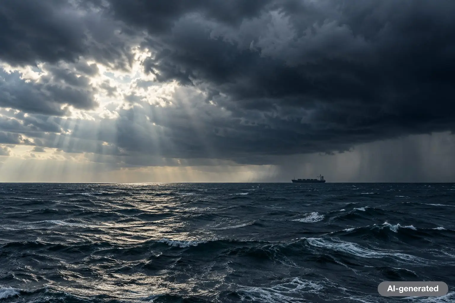
What and where is the Bermuda Triangle?
The Bermuda Triangle, sometimes called the Devil's Triangle, is a loosely defined area of the western North Atlantic. Encyclopaedia Britannica describes it as a roughly triangular region reaching from the Atlantic coast of Florida to Bermuda to the Greater Antilles, with the corners usually placed near Miami, Bermuda and San Juan, Puerto Rico. Because nobody agrees on the borders, estimates of its size range from about 500,000 to 1,510,000 square miles.
That vagueness is the first clue. NOAA notes that no official maps delineate the triangle, and the U.S. Board on Geographic Names does not recognize "Bermuda Triangle" as an official name or keep a file on it. A 1974 article reprinted by the Naval History and Heritage Command made the same point more bluntly: the size of the triangle is dictated by whoever happens to be writing about it, so the list of ships lost inside it depends on which article you read.
Britannica cites the most common estimate of losses attributed to the region as more than 50 ships and 20 airplanes over roughly a century and a half. That sounds alarming until you remember that the area includes some of the busiest shipping lanes and flight paths in the world, plus the approaches to major ports in Florida and the Caribbean.
Where the legend came from: Gaddis, 1964, and Berlitz, 1974
Reports of odd sea losses in the region go back to the mid-1800s, but the phrase "Bermuda Triangle" did not exist until 1964. Britannica traces its first appearance in print to a pulp magazine article by writer Vincent Gaddis, published in the February 1964 issue of Argosy under the title "The Deadly Bermuda Triangle." Gaddis described a triangular area "that has destroyed hundreds of ships and planes without a trace" and tied Flight 19 to other disappearances as if they formed a single pattern. He expanded the idea in his 1965 book Invisible Horizons: True Mysteries of the Sea.
A decade later the idea went mainstream. Charles Berlitz's bestseller The Bermuda Triangle, published by Doubleday in 1974, popularized the legend for millions of readers and, according to Britannica, claimed that the fabled lost island of Atlantis was involved in the disappearances. The same years produced a wave of similar books, among them Richard Winer's The Devil's Triangle (1974), and a stream of television specials.
The librarian who checked the sources
The most influential rebuttal came from Larry Kusche, a reference librarian at Arizona State University, who had compiled a Bermuda Triangle bibliography in 1974. He went back to original newspaper reports, weather records and official inquiries for each famous case. His 1975 book The Bermuda Triangle Mystery Solved documented numerous inaccuracies and inconsistencies between the popular accounts and the original records: details had been embellished, weather was misreported, and stories were copied from book to book without checking. His conclusion was that the mystery had been manufactured largely by careless research and repetition.
"The U.S. Navy and U.S. Coast Guard contend that there are no supernatural explanations for disasters at sea," NOAA writes, adding that "there is no evidence that mysterious disappearances occur with any greater frequency in the Bermuda Triangle than in any other large, well-traveled area of the ocean."
Famous Bermuda Triangle cases: what the records say
Every telling of the legend leans on the same handful of cases. Here is what the Navy's own historians and contemporary records report about the best known.
| Case | Date | People lost | What the record shows |
|---|---|---|---|
| USS Cyclops (Navy collier) | March 1918 | 306 crew and passengers | Left Barbados for Baltimore carrying dense ore; ship designed for coal, with structural and engine concerns. Never found. |
| Flight 19 (five TBM Avengers) | December 5, 1945 | 14 airmen | Leader reported both compasses out and believed he was over the Florida Keys; likely ditched in rough seas at night after running low on fuel. |
| "Training 49" (PBM Mariner searching for Flight 19) | December 5, 1945 | 13 airmen | A tanker saw a burst of flames and an oil slick where the plane vanished from radar; PBMs were prone to gasoline vapor buildup. |
| SS Marine Sulphur Queen (tanker) | February 1963 | 39 crew | Carried 15,000 long tons of molten sulfur heated to 275 degrees F; last heard near Key West. One life jacket found. |
USS Cyclops, 1918
The Naval History and Heritage Command calls the loss of the Cyclops and her 306 crew and passengers in March 1918 the single largest loss of life in U.S. Naval history not directly involving combat, and it remains unsolved. The collier was returning from Brazil to Baltimore with a heavy cargo of manganese ore and stopped at Barbados before vanishing.
Because the loss happened during World War I, many assumed a German submarine or mine. Information obtained from Germany after the war ruled that out. A 2018 analysis by the command's director, Samuel J. Cox, points instead to a combination of factors: the ship was designed to carry coal, not ore that is much denser; years of acidic coal cargo may have eroded the longitudinal support beams; her power plant was reported to be in poor condition; and heavy seas could have broken a weakened hull quickly. Her commander, Lieutenant Commander George Worley, had been born in Germany as Johann Frederick Wichmann, a detail that fed wartime suspicion and decades of speculation. No wreck has ever been located.
Flight 19, 1945
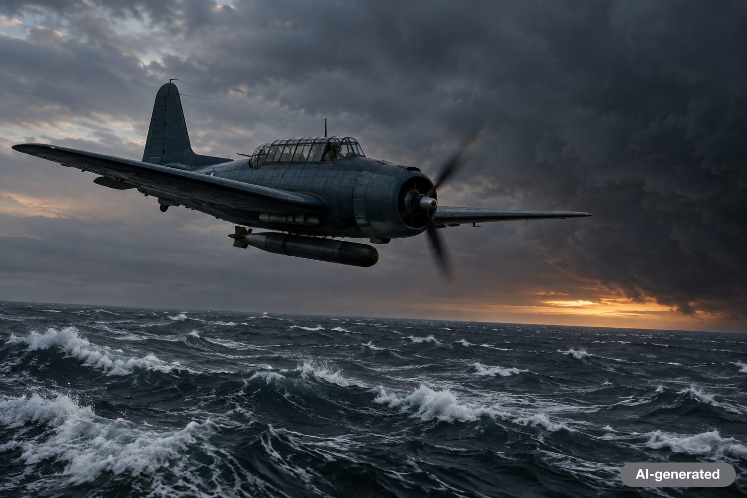
Flight 19 is the case that made the legend. On December 5, 1945, five Navy TBM Avenger torpedo bombers took off from Naval Air Station Fort Lauderdale for a routine training exercise, "Navigation Problem No. 1," with 14 men aboard: six Navy and eight Marines. The route ran east to a bombing target at Hens and Chickens Shoals, north over Grand Bahama, and back to Florida.
According to the Navy's official history, the flight's instructor, Lieutenant Charles C. Taylor, was an experienced combat pilot but was leading this particular route for the first time, having just transferred from Naval Air Station Miami. Around 3:40 p.m. he radioed that both of his compasses were out and that he was sure he was over the Florida Keys. Officers on the ground concluded the flight was actually over the Bahamas. Radio direction-finding later placed the planes north of the Bahamas and east of Florida, but that fix was never transmitted to the aircraft. The planes had no working clocks, and Taylor seemed unsure how long they had been on each heading. Weather deteriorated, seas became very rough, and the last garbled messages talked about ditching together when the first plane ran low on fuel.
The Navy's board of inquiry first blamed the leader's confusion. After his mother challenged that finding, the record was amended to read that the cause "remains unknown." The command's own historian summarizes the most likely explanation as the aircraft ditching as a group off Florida, north of the Bahamas, in the face of a rapidly moving severe weather front, adding drily that it "most certainly wasn't due to aliens or the Bermuda Triangle."
The rescue plane that "vanished too"
Legend says a rescue plane sent after Flight 19 also disappeared without explanation. The record is less mysterious. A Martin PBM-5 Mariner flying boat, call sign "Training 49," took off from Naval Air Station Banana River at about 7:27 p.m. with 13 men. It made one radio call and was never heard from again. At 7:50 p.m., the tanker SS Gaines Mills reported a burst of flames leaping 100 feet high and a large pool of oil at the same position where the escort carrier USS Solomons watched the plane disappear from radar. PBMs were nicknamed "flying gas tanks" because fuel vapors could accumulate inside them, and the inquiry's questions focused on an in-flight fire.
Marine Sulphur Queen, 1963
The tanker Marine Sulphur Queen left Beaumont, Texas, and last radioed her position on February 3, 1963, near Key West in the Florida Straits. Coast Guard searchers later found a single life jacket about 40 miles from that position. She was carrying 15,000 long tons of molten sulfur in heated metal tanks, a cargo with obvious fire and explosion risks. A 1974 Military Sealift Command article noted that no one knows whether she blew up, but it is a real possibility.
What NOAA, the Navy and the Coast Guard say
The official agencies that operate in these waters every day are unanimous.
- NOAA lists the environmental factors that could explain many, if not most, disappearances: the majority of Atlantic tropical storms and hurricanes pass through the area; the Gulf Stream can cause rapid, sometimes violent changes in weather; and the many islands of the Caribbean create shallow water that is treacherous to navigate.
- The U.S. Coast Guard, in a statement reproduced by the Navy Department Library, says it "does not recognize the existence of the so-called Bermuda Triangle as a geographic area of specific hazard to ships or planes," and that its reviews of losses found nothing indicating "anything other than physical causes. No extraordinary factors have ever been identified."
- The U.S. Navy, through its history command, describes the triangle as a "mythical geographic area."
Independent checks point the same way. Britannica reports that a 2013 World Wildlife Fund study of shipping lanes found the Bermuda Triangle was not among the world's ten most dangerous bodies of water for shipping.
Natural explanations: why ships and planes really go missing
The Gulf Stream
The Gulf Stream runs straight through the region. A retired Coast Guard captain quoted in the Navy's 1974 Sealift article described it as a "river within the ocean" that surges north at about four knots along its axis. When it meets strong northeast winds, it builds steep, chaotic seas, and it can carry debris from a sinking far from where it went down, which helps explain why wreckage is often never found where searchers look.
Storms that appear from nowhere
Hurricanes are the obvious danger, and NOAA notes that before modern forecasting they claimed many ships here. Smaller storms can be just as deadly. Meteorologist Joanne Simpson of the University of Miami described small, short-lived storm systems, sometimes nicknamed "neutercanes," that arise quickly over the Gulf Stream, last minutes, and stir up giant waves coming from several directions. Squalls of 75 knots can develop locally on days that look fine on large weather maps.
Rogue waves
Britannica highlights rogue waves, which can reach heights of about 100 feet (30.5 meters). The triangle sits where storms from multiple directions can converge, conditions that make such waves more likely. A wave like that can overwhelm a vessel in seconds and leave little to find.
Deep water and shallow reefs
The region holds both extremes. The Puerto Rico Trench, at the triangle's southern edge, reaches 27,493 feet (8,380 meters) at the Milwaukee Depth, the deepest point in the Atlantic, so wrecks there may never be recovered. Meanwhile, NOAA notes that the many shallow banks around the Bahamas and Caribbean islands are treacherous to navigation.
Compass confusion
NOAA says there is some evidence that the triangle is one of the places where a magnetic compass can point toward true north rather than magnetic north. Britannica explains this as the agonic line, where no correction for magnetic declination is needed, and notes it passed through the region during the early 20th century. A navigator who applied a correction out of habit could drift off course.
Traffic and human error
The simplest explanation is volume. The area carries heavy daily traffic by sea and air, and much of it is recreational boating by people with limited offshore experience. The 1974 Sealift article reported that the Coast Guard had answered about 8,000 distress calls in the area in a single year, roughly 23 a day. More traffic means more accidents, and in open ocean, more accidents mean more vessels that are never found.
What about methane bubbles?
NOAA mentions "oceanic flatulence," methane gas erupting from sea-floor sediments, as one of the more science-flavored ideas, but adds that such theories are grounded in science "if not in evidence." There is no documented case of a ship in the triangle being sunk by a methane blowout.
Why the Bermuda Triangle myth persists
If the evidence is so clear, why does the legend survive? A few forces keep it alive:
- Selective lists. Because the borders move with the author, any loss nearby can be added and any routine accident ignored. The result looks like a cluster even when there is none.
- Missing wreckage. Deep water, strong currents and storms mean many losses leave little trace. A blank space invites a story.
- Repetition without checking. Kusche showed that later books often copied earlier ones, errors included, so dramatic but false details hardened into "facts."
- Pop culture. Flight 19 even appears in the 1977 film Close Encounters of the Third Kind, which, as the Navy's historian notes, depicts the planes being returned by aliens. Each new documentary renews the cycle.
- A good mystery is fun. NOAA's own summary acknowledges that the ocean has always been mysterious to humans. A named, mapped mystery is easier to imagine than a statistical one.
None of that diminishes the real losses. The 306 people aboard the Cyclops, the 14 men of Flight 19 and the 13 aboard the PBM died in ordinary, terrible ways: structural failure, disorientation, storms and fire. Remembering them accurately is a better tribute than turning them into props for a ghost story.

The bottom line
The Bermuda Triangle mystery is explained less by any single discovery than by careful accounting. A heavily traveled, storm-prone patch of ocean with a powerful current and some of the deepest water in the Atlantic will produce losses. A 1964 magazine article gave those losses a name, a 1974 bestseller gave them a myth, and the official agencies that patrol the area have been saying ever since that the cause is weather, water and human error. For more evidence-first explainers, browse our science section or look further out with our space coverage.
Frequently asked questions
Is the Bermuda Triangle actually dangerous?
Not more than other busy ocean areas. NOAA says there is no evidence that disappearances happen more often there than in any other large, well-traveled part of the ocean, and the U.S. Coast Guard does not recognize it as a special hazard area.
Who invented the term Bermuda Triangle?
Writer Vincent Gaddis, in the article "The Deadly Bermuda Triangle" in the February 1964 issue of Argosy magazine. Charles Berlitz's 1974 bestseller The Bermuda Triangle made it world famous.
What happened to Flight 19?
Five Navy Avenger bombers on a training flight from Fort Lauderdale on December 5, 1945, got lost after the leader reported compass failure and believed he was over the Florida Keys. The most likely explanation is that they ran low on fuel and ditched together in rough seas at night.
Was the USS Cyclops ever found?
No. The Navy collier and her 306 crew and passengers disappeared in March 1918 after leaving Barbados for Baltimore. Navy historians point to structural weakness, a dense ore cargo and heavy seas as likely factors.
Do planes and ships still travel through the Bermuda Triangle?
Yes, constantly. The area includes some of the busiest shipping lanes and flight routes in the world, and boaters and pilots cross it every day without incident.
What is the best scientific explanation for the disappearances?
A combination of hurricanes and sudden storms, the fast Gulf Stream, rogue waves, very deep water, shallow reefs, occasional compass confusion and heavy traffic with human error.
Sources
- NOAA National Ocean Service: What is the Bermuda Triangle?
- Naval History and Heritage Command: The Bermuda Triangle, a selective bibliography and Coast Guard statement
- Naval History and Heritage Command: H-057-4, The Disappearance of Flight 19
- Naval History and Heritage Command: H-016-4, USS Cyclops
- Naval History and Heritage Command: Exorcizing the Devil's Triangle (Sealift, 1974)
- U.S. Coast Guard History: Frequently Asked Questions
- Encyclopaedia Britannica: Bermuda Triangle
- Encyclopaedia Britannica: What Is Known (and Not Known) About the Bermuda Triangle


Log in to comment
No comments yet. Be the first.