Winter Weather Guide 2026–27: Warnings, Ice, Polar Vortex, Wind Chill, Outlook and Storm Prep
Winter in the United States is not one kind of weather. It is blizzards on the northern Plains, ice storms in Oklahoma and Georgia, lake-effect snow off the Great Lakes, nor'easters along the East Coast and Arctic air that can push wind chills far below zero. The Winter Weather Guide 2026–27 from 77.today explains all of it in seven in-depth parts: what every National Weather Service winter storm warning, watch and advisory means (including the official blizzard warning criteria), how freezing rain, sleet and snow form, what the polar vortex and a bomb cyclone really are, how to read the wind chill chart, what NOAA's official winter forecast 2026–27 says, how to prepare your home and car, and how schools decide snow days. Every fact comes from primary sources such as weather.gov, noaa.gov, the Climate Prediction Center, the CDC and ready.gov, listed at the end.
Winter 2026–27 at a glance
Three things set this winter apart. First, a very strong El Niño. In its October 8, 2026, update the Climate Prediction Center kept an El Niño Advisory in place and said a strong-to-very strong El Niño is likely through January–March 2027, with a high chance that it becomes one of the strongest on record since 1950. Second, NOAA's official U.S. Winter Outlook, released October 15, 2026, favors a warmer-than-average winter across the northern U.S. and Alaska, a wetter-than-average southern tier from California to Florida, a wetter East Coast and improving drought across much of the country. Third, the National Weather Service has new tools: "Particularly Dangerous Situation" wording for the most extreme blizzard and ice storm warnings, and a Probabilistic Precipitation Portal that shows low-end, expected and high-end snow and ice amounts.
None of that means an easy winter. A seasonal outlook describes the odds for a three-month average. It cannot rule out a week of brutal Arctic air, a blizzard or an ice storm, and NOAA does not forecast seasonal snowfall at all. The practical message is the same every year: know the alerts, prepare before the first storm and follow your local NWS office.
| Date | What happens |
|---|---|
| October 1, 2026 | NWS can add 'Particularly Dangerous Situation' wording to extreme blizzard and ice storm warnings |
| October 8, 2026 | CPC ENSO update: El Niño Advisory, strong-to-very strong El Niño likely through Jan–Mar 2027 |
| October 15, 2026 | NOAA U.S. Winter Outlook: warmer North, wetter South and East |
| November 12, 2026 | Next CPC ENSO Diagnostic Discussion |
| November 19, 2026 | Next NOAA three-month outlook update |
| December 1, 2026 | Start of meteorological winter (Dec–Feb) |
Winter weather alerts explained
All winter alerts come from your local NWS forecast office, and each office sets its own criteria. That is why a few inches of snow can trigger a warning in the Southeast and only an advisory in Minnesota. The ladder is simple, and the NWS pairs each level with an instruction: a watch means be prepared, a warning means take action, an advisory means be aware. This table lists the winter alerts you are most likely to see in 2026–27.
| Alert | Level | Meaning | Your move |
|---|---|---|---|
| Winter Storm Watch | Be prepared | A significant winter storm is possible | Stock up, fuel up, charge devices |
| Winter Storm Warning | Take action | Significant snow, sleet, ice or blowing snow expected or occurring | Delay travel |
| Blizzard Warning | Take action | Frequent 35 mph+ gusts and visibility under 1/4 mile in snow for 3+ hours | Do not travel |
| Ice Storm Warning | Take action | Ice accumulation, usually about 1/4 inch or more | Prepare for outages; stay off roads |
| Snow Squall Warning | Take action | Brief, intense burst of snow and wind with sudden whiteouts | Delay driving until it passes |
| Lake Effect Snow Warning | Take action | Heavy lake-effect snow bands | Avoid travel through the bands |
| Winter Weather Advisory | Be aware | Wintry weather below warning criteria | Slow down, allow extra time |
| Extreme Cold Watch | Be prepared | Dangerous cold or wind chills possible | Plan to limit time outdoors |
| Extreme Cold Warning | Take action | Dangerous cold or wind chills expected or occurring | Avoid going outside |
| Cold Weather Advisory | Be aware | Dangerous cold below warning criteria | Cover exposed skin, dress in layers |
Two changes are worth knowing. On October 1, 2024, the NWS renamed its cold alerts: wind chill watches, warnings and advisories became Extreme Cold Watches and Warnings and Cold Weather Advisories, because cold is dangerous with or without wind. And starting on or about October 1, 2026, the NWS can add "Particularly Dangerous Situation" wording to selected blizzard and ice storm warnings when it is confident a storm will be of historic severity. Also note that only short-fused snow squall warnings are on the NWS list of alerts pushed to phones as Wireless Emergency Alerts; for blizzard, ice storm and winter storm warnings you need weather.gov, an app or a NOAA Weather Radio.
Watch = be prepared, the storm is possible. Warning = take action, it is expected or happening. Advisory = be aware, it will be a nuisance and can still be dangerous on the roads. Everything else in this guide builds on those three.
The seven parts of the guide
1. Winter storm warning vs. watch vs. advisory: blizzard warnings explained
The first part is the decoder ring for every winter alert. It explains the difference between a winter storm watch vs. warning (confidence) and a winter weather advisory vs. warning (severity), why there is no national snowfall number for a winter storm warning, and the official blizzard criteria: frequent gusts of 35 mph or more with falling or blowing snow cutting visibility below a quarter mile for three hours or more, with no minimum snowfall. It also covers ice storm warnings, snow squall and lake-effect warnings, the renamed Extreme Cold alerts, the new PDS wording, the best ways to receive alerts, and the common mistakes people make, such as treating a watch as "probably nothing" or judging a blizzard by its snow total.
2. Freezing rain vs. sleet vs. snow: how ice storms form
"Freezing rain vs. sleet" is one of the most searched winter weather questions in the country, and the answer comes down to a warm layer of air aloft. When snowflakes fall through it and partly melt, they refreeze into sleet; when they melt completely and fall through a thin cold layer near the ground, they become supercooled drops that freeze on contact as freezing rain.
| Type | How it forms | Main hazard |
|---|---|---|
| Snow | Stays at or below 32°F from cloud to ground | Visibility, heavy loads, slick roads |
| Sleet | Partly melts in a warm layer, refreezes into pellets | Very slick roads, heavy to shovel |
| Freezing rain | Melts fully, freezes on contact with surfaces at or below 32°F | Ice storms, power outages, black ice |
This part explains why freezing rain causes ice storms and long power outages, how the Sperry-Piltz Ice Accumulation Index rates ice damage from 0 to 5 using both ice and wind, why sleet and hail are completely different kinds of ice, and how to drive on freezing rain and black ice, including the NWS rule never to pump anti-lock brakes.
3. Polar vortex and bomb cyclone explained
The polar vortex is not a storm and not new. It is a permanent ring of strong winds in the stratosphere, roughly 10 to 30 miles above the North Pole, that holds the coldest air over the Arctic. When it is disrupted by a sudden stratospheric warming, which NOAA experts say happens about every other year, the jet stream can buckle and send Arctic air deep into the U.S. A bomb cyclone is something else: a storm whose central pressure falls at least 24 millibars in 24 hours at 60°N, or about 17.8 millibars at New York City's latitude. This part walks through both, with a table of notable events: the 2014 cold wave, the January 2018 "bomb cyclone," Chicago's −23°F on January 30, 2019, the February 2021 Texas freeze, Winter Storm Elliott in December 2022 and the January–February 2026 cold wave. It also looks honestly at what science can and cannot say about climate change and the vortex.
4. Wind chill chart, formula and frostbite times
Wind chill is how cold it feels on exposed skin, and it decides how fast frostbite can set in. This part publishes the official NWS formula, a wind chill chart in Fahrenheit from 40°F to −30°F and from 5 to 60 mph, and NWS and NOAA examples of frostbite times, from about 30 minutes at a −19°F wind chill to 5 minutes or less in extreme cases. It explains what wind chill does not do (it cannot cool pipes or cars below the air temperature, and frostbite needs air below freezing), the local criteria behind Extreme Cold Warnings, how to dress in layers according to the CDC, and how to apply the chart to motorcycles and other speed-driven wind.
5. Winter forecast 2026–27: NOAA's outlook, El Niño and the almanacs
What will winter be like where you live? This part goes region by region through NOAA's October 15, 2026, outlook for temperature, precipitation and drought, explains how to read the probability maps, and gives the latest El Niño numbers from the CPC, including why this is not a La Niña winter. It also compares NOAA with the Farmers' Almanac and The Old Farmer's Almanac: their 2026–27 headlines, how each says it makes its forecast, and why NOAA does not forecast snow totals months ahead. No invented forecasts; only what each source actually published.
6. How to prepare for a winter storm: checklists
The practical part. It turns guidance from ready.gov, the NWS, the CDC and the American Red Cross into checklists for the home, the car and power outages: what to keep in a winter survival kit, what to do if you are stranded in a car (stay inside, run the engine about 10 minutes an hour, clear the tailpipe), how to keep pipes from freezing (drip faucets, steady thermostat, never below 55°F when away), how long food lasts in a fridge or freezer without power, and how to use a generator without risking carbon monoxide poisoning, which the CDC says kills more than 400 Americans a year outside of fires. Pets, livestock and apartment living are covered too.
7. How schools decide snow days
The final part answers a question every family asks on a snowy night. Superintendents usually decide after staff drive the roads before dawn and after checking the NWS forecast; when a storm is uncertain, many districts decide by about 4:30 a.m. The part explains the factors (overnight snow and ice, road conditions, wind chill at bus stops, buses, staff and campus conditions), why ice and cold close schools without much snow, why some districts such as New York City switched to remote learning instead of traditional snow days, and how snow day calculators turn the forecast into odds. For tonight's odds at your school, try the 77.today snow day calculator, which reads the NWS forecast for your ZIP code.
Where winter hits hardest: a quick regional guide
- Northern Plains and Upper Midwest: blizzards and ground blizzards on open land, and the coldest wind chills in the lower 48. Know the wind chill chart and keep a car kit.
- Great Lakes: lake-effect snow bands that can bury one town and spare the next, plus snow squalls on highways.
- Northeast and Mid-Atlantic: nor'easters, some of which become bomb cyclones, with snow inland and rain or a wintry mix near the coast.
- South and Southern Plains: rarer snow but frequent ice; a quarter inch of freezing rain can shut down a region. NOAA's 2026–27 outlook favors a stormier southern tier.
- West and Rockies: mountain snow, avalanches and Pacific storms; NOAA favors a wetter Southwest and a drier northern Rockies this winter.
Five things to do before the first storm
- Set up alerts from weather.gov and get a battery-powered NOAA Weather Radio.
- Build a home kit for several days without power: light, food, water, medicine, first aid and pet supplies (full checklist).
- Put a winter survival kit in the car and keep the gas tank at least half full.
- Install carbon monoxide detectors on every level of your home, and plan where a generator would run outdoors, at least 20 feet from windows and doors.
- Protect your pipes and know where your main water shutoff is.
How we built this guide
Every number in the Winter Weather Guide comes from a named source: National Weather Service safety pages and service change notices, NOAA's winter outlook and Ocean Service, the Climate Prediction Center's ENSO discussion, NOAA Climate.gov, NOAA's National Severe Storms Laboratory, the CDC, ready.gov and the American Red Cross, with news and reference sources for historical events and school decisions. Where something is uncertain, such as the long-range behavior of the polar vortex or the accuracy of almanac forecasts, we say so rather than guess. We will update the outlook part after NOAA's November 19 update and the CPC's November 12 ENSO discussion.
Winter nights are also prime time for the sky: the long dark hours are the best season to look for auroras and meteor showers. See the night sky guide and the northern lights forecast.
Start with the alerts in part 1, or jump straight to the 2026–27 winter forecast.
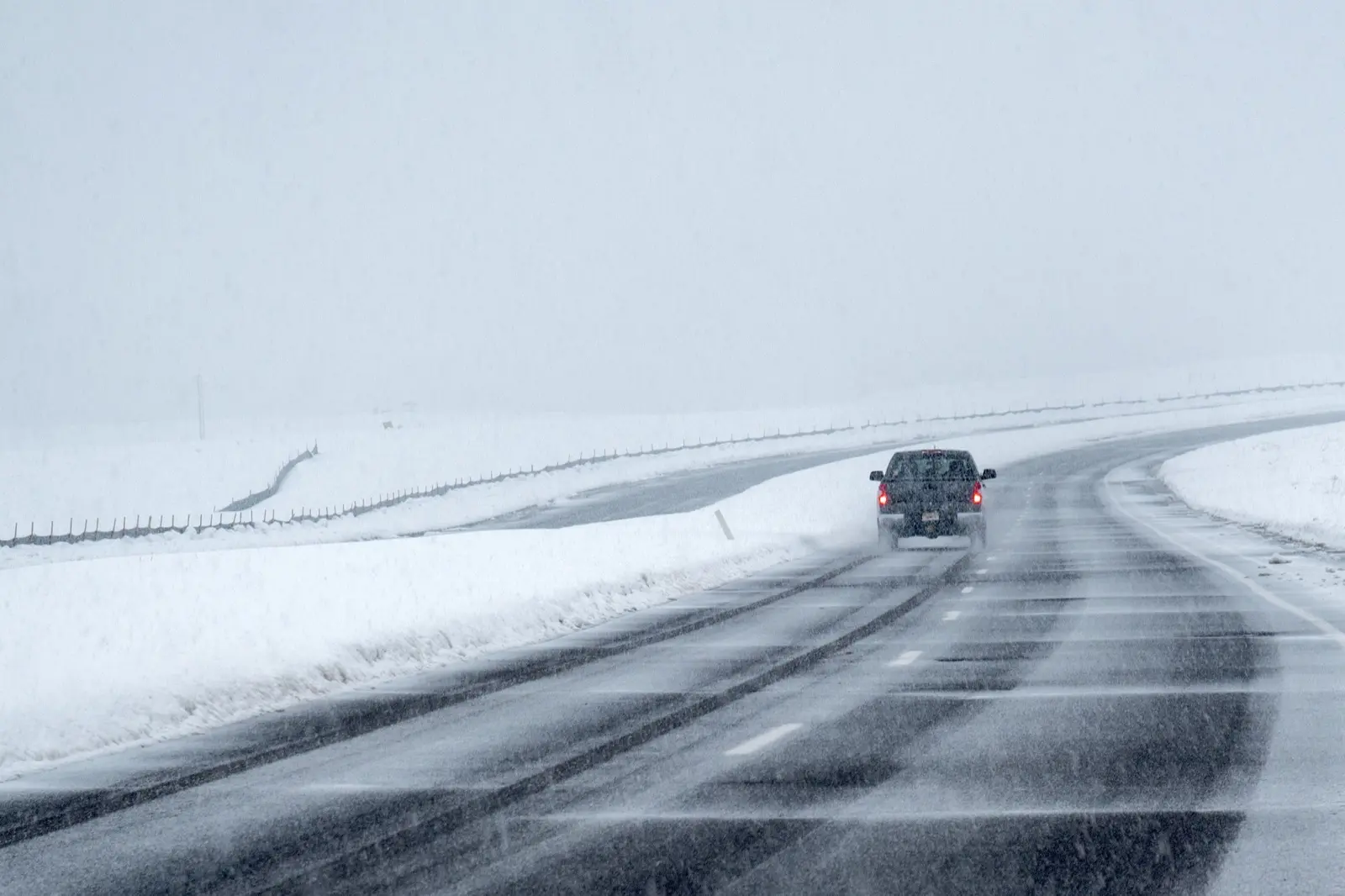
Cover image: A car drives through a snowstorm in Broomfield, Colorado, in March 2024. Photo by Bob Hyatt/NOAA via noaa.gov, public domain (U.S. government work).
Frequently asked questions
What is the difference between a winter storm watch and a warning?
A watch means a significant winter storm is possible, so prepare. A warning means it is expected or already happening, so take action, mainly by delaying travel.
What are the criteria for a blizzard warning?
The NWS issues a blizzard warning for frequent gusts of 35 mph or more with falling or blowing snow frequently reducing visibility below 1/4 mile for three hours or more. No minimum snowfall is required.
What is the winter forecast for 2026–27?
NOAA's October 15, 2026, outlook favors a warmer-than-average northern U.S. and Alaska, wetter conditions across the southern tier and East Coast, and improving drought for much of the country, driven by a very strong El Niño.
Is winter 2026–27 a La Niña winter?
No. The Climate Prediction Center has an El Niño Advisory in effect and expects a strong-to-very strong El Niño through January–March 2027.
What is the difference between freezing rain and sleet?
Sleet is snow that partly melts and refreezes into ice pellets before landing. Freezing rain melts completely and freezes on contact with surfaces at or below 32°F, creating a glaze that causes ice storms.
What is a bomb cyclone?
A storm that intensifies rapidly, with central pressure falling at least 24 millibars in 24 hours at 60°N, or about 17.8 millibars at New York City's latitude.
At what wind chill does frostbite happen?
On the NWS chart, a wind chill of about −19°F (0°F with a 15 mph wind) can freeze exposed skin in about 30 minutes; colder, windier conditions can cause frostbite in 10 or even 5 minutes.
How far should a generator be from the house?
The CDC and ready.gov say generators must run only outdoors, at least 20 feet from windows, doors and vents.
All parts of the guide
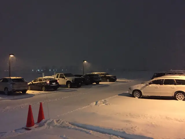 Winter storm warning vs. watch vs. advisoryEvery NWS winter alert explained: watch vs. warning vs. advisory, the official blizzard warning criteria, ice storm and snow squall warnings, and the new Extreme Cold names.
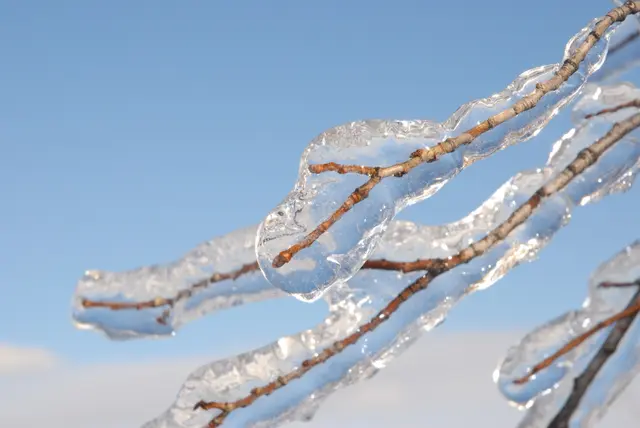 Freezing rain vs. sleet vs. snow vs. ice stormHow snow, sleet and freezing rain form, why freezing rain causes ice storms, sleet vs. hail, the Sperry-Piltz ice damage index and how to drive on ice.
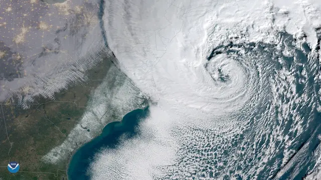 Polar vortex and bomb cyclone explainedWhat the polar vortex really is, how sudden stratospheric warmings send Arctic air south, the bombogenesis threshold by latitude, and notable U.S. events from 2014 to 2026.
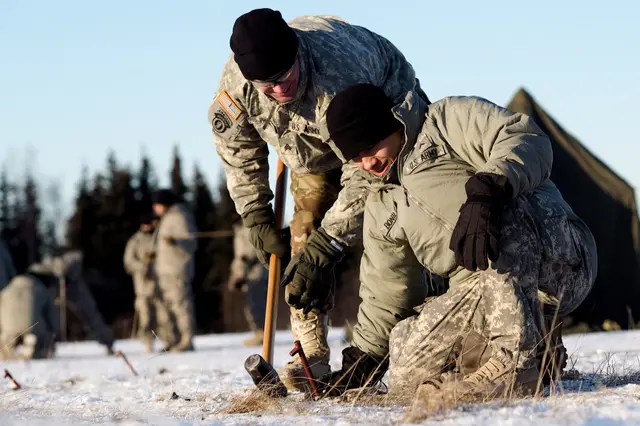 Wind chill chart, formula and frostbite timesThe official NWS wind chill formula and chart in °F, how fast frostbite sets in, Extreme Cold Warnings, and how to dress in layers for dangerous cold.
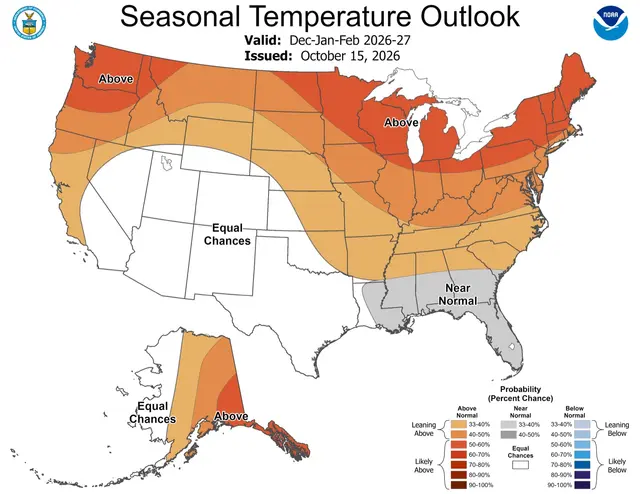 Winter 2026–27 outlook: NOAA, El Niño and the almanacsWhat NOAA's official 2026–27 winter outlook says region by region, the current El Niño status, why it is not a La Niña winter, and how the almanacs compare.
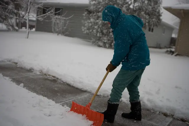 How to prepare for a winter storm: checklistsOfficial checklists for home, car and power outages: winter survival kit, generator and carbon monoxide safety, frozen pipes, what to do if stranded, and pets.
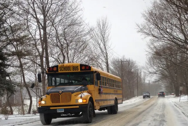 Snow days: how schools decide and how calculators workWho decides a snow day, the factors and the 4:30 a.m. timeline, how much snow it takes by region, ice and cold closings, remote learning, and an honest look at snow day calculators.
Sources
- National Weather Service – Winter Weather Warnings, Watches and Advisories
- National Weather Service – Understanding Cold Weather Alerts
- NWS Service Change Notice 26-52 – PDS wording
- National Weather Service – Wireless Emergency Alerts
- NOAA – El Nino looms large over U.S. Winter Outlook (Oct. 15, 2026)
- NOAA Climate Prediction Center – ENSO Diagnostic Discussion (Oct. 8, 2026)
- NOAA National Severe Storms Laboratory – Winter Weather Types
- NOAA Climate.gov – Understanding the Arctic polar vortex
- NOAA National Ocean Service – What is bombogenesis?
- National Weather Service – Understanding Wind Chill
- CDC – Carbon Monoxide Poisoning Basics
- Ready.gov – Winter Weather
- WJLA – What influences school systems to close or delay start times?
Log in to comment
No comments yet. Be the first.